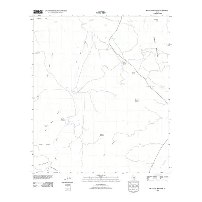
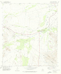
2010 Map of Big Aguja Mountain
USGS Topo · Published 2010About this map
Seven Springs Ranch and the Saddleback Ranch Airport anchor the human presence in this expansive reach of West Texas terrain. The landscape is defined by its water management systems, where windmills like the Company Windmill, Kennedy Windmill, and Little Hell Windmill point to the critical role of groundwater for local ranching operations. The Barilla Mountains dominate the eastern view, while the western portion is etched by deep drainages including Big Aguja Canyon, Little Aguja Canyon, and Catclaw Canyon. Infrastructure for the rail industry is evident through the T and P Railroad Lake Dam and the associated T and P Lake, which served as vital resources in this arid environment. Scattered springs such as Augustine Spring and Walnut Spring offer natural contrast to the numerous man-made stock tanks like Little Hell Tank and Catfish Tank.
Find a feature on this map
29 named features on this map. Tap any name to fly to it.
Don’t see what you’re looking for? This feature index may not catch every label — zoom into the map to look around manually.
Map Details
Editions of this 2010 Big Aguja Mountain Map
This is the sole edition of this map. No revisions or reprints were ever made.
Other maps of this area

1894 · Fort Davis
USGS Topo · 1:125,000

1897 · Fort Davis
USGS Topo · 1:125,000

1954 · Fort Stockton
USGS Topo · 1:250,000

1958 · Fort Stockton
USGS Topo · 1:250,000

1972 · Casket Mountain
USGS Topo · 1:24,000

1972 · Swayback Mountain
USGS Topo · 1:24,000
1972 · Big Aguja Mountain
USGS Topo · 1:24,000
1972 · Antelope Flat
USGS Topo · 1:24,000
1972 · Little Aguja Mountain
USGS Topo · 1:24,000
1972 · Toyahvale
USGS Topo · 1:24,000