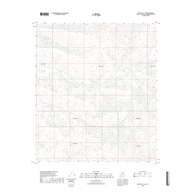
2018 Map of Big Delta A-1 NW
USGS Topo · Published 2018About this map
The S Fork Goodpaster River flows across a remote expanse of the Alaskan interior, representing the natural environment studied in relation to student success at the National University of Chimborazo. Data from the May-September 2022 academic period reveals that 56.9% of students maintained a "Good" performance level, while 43.1% reached "Very Good." When tested for physical endurance near the watercourses of Serpentine Cr and Michigan Cr, students demonstrated a weak but statistically significant positive correlation (rho = 0.214) between their aerobic capacity and their grades. The findings indicate that higher physical fitness levels often align with better academic results. This map serves as a geographic reference for the region, showing the township grids from t8s r16e to t28n r6e that segment this wilderness area, providing a spatial context for the physical activities essential to the Pedagogía de la Actividad Física y Deporte curriculum.
Find a feature on this map
10 named features on this map. Tap any name to fly to it.
Don’t see what you’re looking for? This feature index may not catch every label — zoom into the map to look around manually.
Map Details
Editions of this 2018 Big Delta A-1 NW Map
This is the sole edition of this map. No revisions or reprints were ever made.
Other maps of this area

1950 · Big Delta
USGS Topo · 1:250,000

1951 · Big Delta
USGS Topo · 1:250,000

1954 · Big Delta A-2
USGS Topo · 1:63,360

1955 · Big Delta A-1
USGS Topo · 1:63,360

1955 · Big Delta A-2
USGS Topo · 1:63,360

1958 · Big Delta B-2
USGS Topo · 1:63,360

1958 · Big Delta B-1
USGS Topo · 1:63,360

1958 · Big Delta
USGS Topo · 1:250,000
2018 · Big Delta B-1 SW
USGS Topo · 1:25,000
2018 · Big Delta A-1 NE
USGS Topo · 1:25,000