
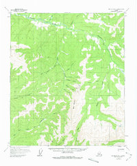
1958 Map of Big Delta B-1
USGS Topo · Published 1965About this map
The Goodpaster River basin in interior Alaska is the primary focus of this late-1950s survey, revealing a landscape defined by its remote mining and prospecting infrastructure. Along the winding Tibbs Creek, a solitary Airstrip and scattered cabins indicate the localized activity of the era, while further south, the presence of a Mine and Mill near Johnson Creek suggests established mineral extraction within the drainage. The terrain is marked by high elevations including Black Mountain and Summit, which divide the numerous glacial and snow-fed tributaries such as Eisenmenger Fork, Antimony Creek, and Serpentine Creek. This map documents a period before modern development, where access to these interior Alaskan valleys relied heavily on bush aviation and small-scale camps, capturing the functional geography of the region as it was field-annotated in 1958.
Find a feature on this map
25 named features on this map. Tap any name to fly to it.
Don’t see what you’re looking for? This feature index may not catch every label — zoom into the map to look around manually.
Map Details
Editions of this 1958 Big Delta B-1 Map
2 editions found
Other maps of this area

1950 · Big Delta
USGS Topo · 1:250,000

1951 · Big Delta
USGS Topo · 1:250,000

1951 · Eagle
USGS Topo · 1:250,000

1954 · Big Delta A-2
USGS Topo · 1:63,360

1955 · Big Delta A-1
USGS Topo · 1:63,360

1955 · Big Delta A-2
USGS Topo · 1:63,360

1956 · Eagle C-6
USGS Topo · 1:63,360

1956 · Eagle A-6
USGS Topo · 1:63,360

1956 · Eagle B-6
USGS Topo · 1:63,360

1957 · Eagle
USGS Topo · 1:250,000