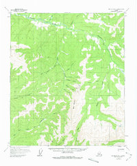
1958 Map of Big Delta B-1
USGS Topo · Published 1979About this map
Grizzly Bear Mine and a nearby Mill sit at the heart of this mid-century topographic survey, signaling the mineral extraction focus of this remote Alaskan interior landscape. The drainage system is dominated by the Goodpaster River, which receives a complex network of tributaries including Tibbs Creek, Wolverine Creek, and Antimony Creek. The topography is defined by significant elevations such as Black Mountain and a prominent Summit to the east.
Find a feature on this map
23 named features on this map. Tap any name to fly to it.
Don’t see what you’re looking for? This feature index may not catch every label — zoom into the map to look around manually.
Map Details
Editions of this 1958 Big Delta B-1 Map
2 editions found

Other maps of this area

1950 · Big Delta
USGS Topo · 1:250,000

1951 · Big Delta
USGS Topo · 1:250,000

1951 · Eagle
USGS Topo · 1:250,000

1954 · Big Delta A-2
USGS Topo · 1:63,360

1955 · Big Delta A-1
USGS Topo · 1:63,360

1955 · Big Delta A-2
USGS Topo · 1:63,360

1956 · Eagle C-6
USGS Topo · 1:63,360

1956 · Eagle A-6
USGS Topo · 1:63,360

1956 · Eagle B-6
USGS Topo · 1:63,360

1957 · Eagle
USGS Topo · 1:250,000