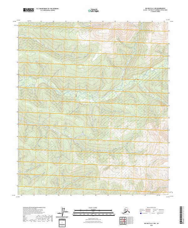
2024 Map of Big Delta A-1 NW
USGS Topo · Published 2024About this map
South Fork Goodpaster River dominates the central portion of this wilderness landscape in the Southeast Fairbanks Census Area. The river is fed by several significant tributaries, including Serpentine Creek which descends from the northern high ground. In the southern reach of the quadrangle, Michigan Creek carves through the terrain, illustrating the intricate drainage patterns of this Alaskan interior. This 2024 survey reflects the modern hydrographic and topographic state of the region, providing a baseline for environmental study and backcountry navigation. The absence of roads or named settlements underscores the isolated character of this region, where the Public Land Survey System grid lines for t28n r5e and t8s r17e define the legal administrative divisions across the open landscape.
Find a feature on this map
10 named features on this map. Tap any name to fly to it.
Don’t see what you’re looking for? This feature index may not catch every label — zoom into the map to look around manually.
Map Details
Editions of this 2024 Big Delta A-1 NW Map
This is the sole edition of this map. No revisions or reprints were ever made.
Other maps of this area

1950 · Big Delta
USGS Topo · 1:250,000

1951 · Big Delta
USGS Topo · 1:250,000

1954 · Big Delta A-2
USGS Topo · 1:63,360

1955 · Big Delta A-1
USGS Topo · 1:63,360

1955 · Big Delta A-2
USGS Topo · 1:63,360

1958 · Big Delta B-2
USGS Topo · 1:63,360

1958 · Big Delta B-1
USGS Topo · 1:63,360

1958 · Big Delta
USGS Topo · 1:250,000
2018 · Big Delta B-1 SW
USGS Topo · 1:25,000
2018 · Big Delta A-1 NE
USGS Topo · 1:25,000