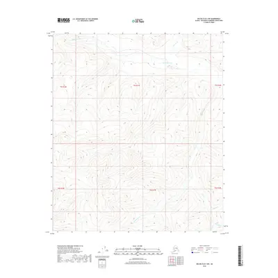
2018 Map of Big Delta B-1 NW
USGS Topo · Published 2018About this map
The Goodpaster River winds through the northern portion of this interior Alaskan wilderness, serving as the primary drainage for a network of steep tributary streams. This 2018 survey documents a remote landscape defined by its complex hydrology, where northern-flowing waters like Slate Cr meet the river, while southern drainages including California Cr and Last Chance Cr carve deep into the high elevations. The area’s geography is further shaped by the presence of Tibbs Cr, which flows through the eastern corridor, and smaller features such as Granite Cr and Wolverine Cr in the southeast. This map captures the undeveloped character of the Southeast Fairbanks Census Area, illustrating the precise topography of the ridgelines and creek beds that define the region's raw natural structure.
Find a feature on this map
13 named features on this map. Tap any name to fly to it.
Don’t see what you’re looking for? This feature index may not catch every label — zoom into the map to look around manually.
Map Details
Editions of this 2018 Big Delta B-1 NW Map
This is the sole edition of this map. No revisions or reprints were ever made.
Other maps of this area

1950 · Big Delta
USGS Topo · 1:250,000

1951 · Big Delta
USGS Topo · 1:250,000

1958 · Big Delta B-2
USGS Topo · 1:63,360

1958 · Big Delta B-1
USGS Topo · 1:63,360

1958 · Big Delta C-2
USGS Topo · 1:63,360

1958 · Big Delta C-1
USGS Topo · 1:63,360

1958 · Big Delta
USGS Topo · 1:250,000
2018 · Big Delta B-1 SW
USGS Topo · 1:25,000
2018 · Big Delta B-2 SE
USGS Topo · 1:25,000
2018 · Big Delta C-1 SE
USGS Topo · 1:25,000