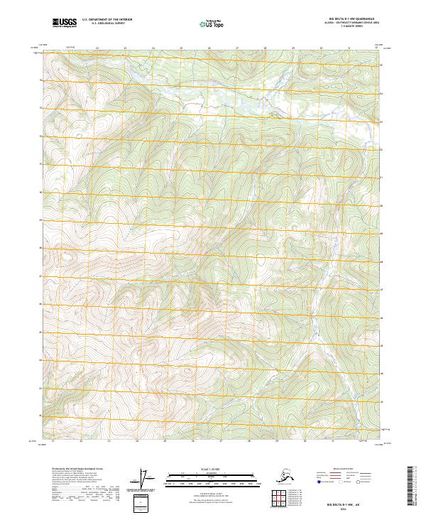
2024 Map of Big Delta B-1 NW
USGS Topo · Published 2024About this map
Goodpaster River winds through the northern reaches of this interior Alaskan landscape, serving as the primary drainage for a network of steep tributary streams. The terrain is defined by its dramatic relief, where narrow valleys carved by Slate Creek and Tibbs Creek separate high, unnamed ridges. The Absence of established roads or settlements on this survey emphasizes the wilderness character of the Southeast Fairbanks Census Area. Moving south, the watershed transitions toward Last Chance Creek and California Creek, while Granite Creek occupies the southeastern corner. This modern topographic study reveals the intricate drainage patterns and elevation profiles of a region defined almost entirely by its hydrography and public land survey boundaries, providing a clear view of the natural corridors used for navigation and backcountry access.
Find a feature on this map
12 named features on this map. Tap any name to fly to it.
Don’t see what you’re looking for? This feature index may not catch every label — zoom into the map to look around manually.
Map Details
Editions of this 2024 Big Delta B-1 NW Map
This is the sole edition of this map. No revisions or reprints were ever made.
Other maps of this area

1950 · Big Delta
USGS Topo · 1:250,000

1951 · Big Delta
USGS Topo · 1:250,000

1958 · Big Delta B-2
USGS Topo · 1:63,360

1958 · Big Delta B-1
USGS Topo · 1:63,360

1958 · Big Delta C-2
USGS Topo · 1:63,360

1958 · Big Delta C-1
USGS Topo · 1:63,360

1958 · Big Delta
USGS Topo · 1:250,000
2018 · Big Delta B-1 SW
USGS Topo · 1:25,000
2018 · Big Delta B-2 SE
USGS Topo · 1:25,000
2018 · Big Delta C-1 SE
USGS Topo · 1:25,000