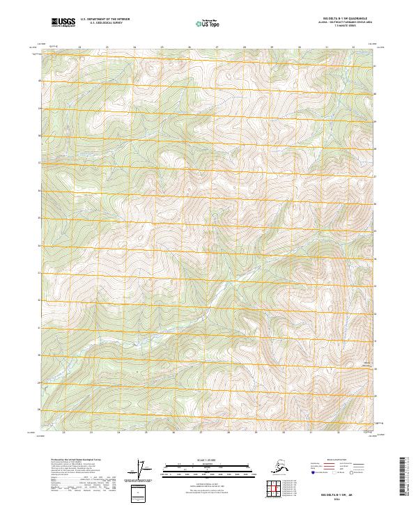
2024 Map of Big Delta B-1 SW
USGS Topo · Published 2024About this map
The Mertie Mountains dominate the eastern topography of this interior Alaska wilderness, where steep drainages define the landscape. This 2024 survey tracks the intricate hydrography of the West Fork South Fork Goodpaster River as it winds through deep valleys in the southern portion of the quadrangle. The northern reaches are shaped by a network of north-flowing tributaries including Antimony Creek, Johnson Creek, and King Creek. Further west, the drainage of Central Creek cuts through several township ranges, illustrating the systematic Public Land Survey System divisions in this undeveloped region. The map reveals a land defined almost entirely by its watershed patterns, from the heights of the Mertie Mountains to the lower reaches of Tibbs Creek and Serpentine Creek, providing a foundational view of the local geography before any significant human infrastructure or road networks have reached these specific coordinates.
Find a feature on this map
17 named features on this map. Tap any name to fly to it.
Don’t see what you’re looking for? This feature index may not catch every label — zoom into the map to look around manually.
Map Details
Editions of this 2024 Big Delta B-1 SW Map
This is the sole edition of this map. No revisions or reprints were ever made.
Other maps of this area

1950 · Big Delta
USGS Topo · 1:250,000

1951 · Big Delta
USGS Topo · 1:250,000

1954 · Big Delta A-2
USGS Topo · 1:63,360

1955 · Big Delta A-1
USGS Topo · 1:63,360

1955 · Big Delta A-2
USGS Topo · 1:63,360

1958 · Big Delta B-2
USGS Topo · 1:63,360

1958 · Big Delta B-1
USGS Topo · 1:63,360

1958 · Big Delta
USGS Topo · 1:250,000
2018 · Big Delta B-1 SW
USGS Topo · 1:25,000
2018 · Big Delta A-1 NE
USGS Topo · 1:25,000