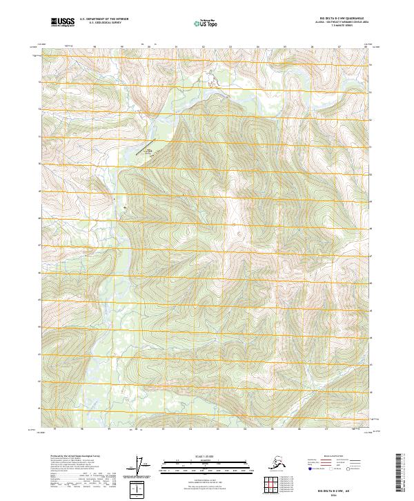
2024 Map of Big Delta B-2 NW
USGS Topo · Published 2024About this map
The Goodpaster River serves as the central drainage for this section of the Southeast Fairbanks interior, cutting a path through the high-elevation terrain where Indian Creek and Central Creek converge. This modern survey reflects the industrial footprint of the region, centered on the Pogo Mine Airstrip located in the northern half of the quadrangle. The landscape is defined by its water system, with Indian Creek feeding the main river from the north, while Sonora Creek and Central Creek drain the southern ridges. The presence of a dedicated airstrip emphasizes the specialized nature of this remote area, which is primarily dedicated to resource extraction rather than established town settlements.
Find a feature on this map
10 named features on this map. Tap any name to fly to it.
Don’t see what you’re looking for? This feature index may not catch every label — zoom into the map to look around manually.
Map Details
Editions of this 2024 Big Delta B-2 NW Map
This is the sole edition of this map. No revisions or reprints were ever made.
Other maps of this area

1950 · Big Delta
USGS Topo · 1:250,000

1951 · Big Delta
USGS Topo · 1:250,000

1958 · Big Delta B-3
USGS Topo · 1:63,360

1958 · Big Delta C-3
USGS Topo · 1:63,360

1958 · Big Delta B-2
USGS Topo · 1:63,360

1958 · Big Delta C-2
USGS Topo · 1:63,360

1958 · Big Delta
USGS Topo · 1:250,000
2016 · Big Delta C-3 SE
USGS Topo · 1:25,000
2016 · Big Delta B-3 SE
USGS Topo · 1:25,000
2016 · Big Delta B-3 NE
USGS Topo · 1:25,000