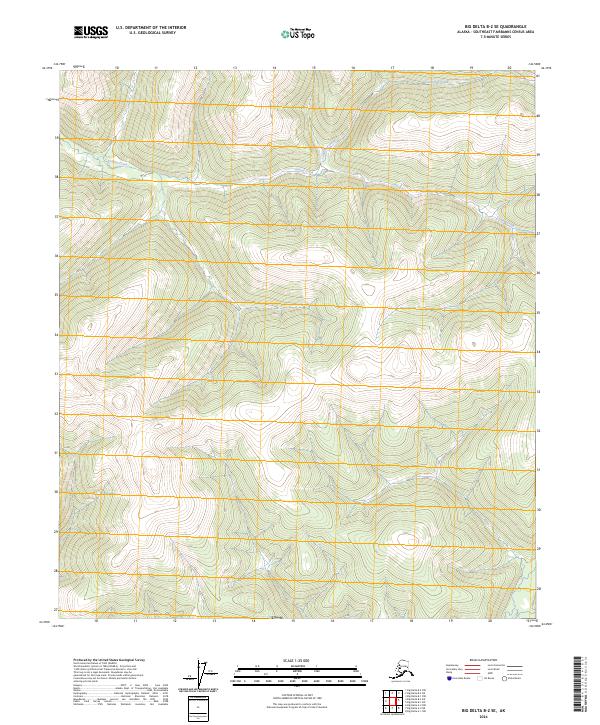
2024 Map of Big Delta B-2 SE
USGS Topo · Published 2024About this map
Central Creek and California Creek define the drainage patterns of this upland terrain in the Southeast Fairbanks region. This 2024 survey depicts a landscape characterized by its elevation and watercourses, mapped with modern precision through the National Elevation and Hydrography Datasets. The map highlights the intersection of several townships including t6s r15e, t7s r16e, and t8s r16e, providing a clear record of the Public Land Survey System boundaries in this part of Alaska. While primarily a topographic study of high-latitude terrain, the detailed contour intervals and creek alignments offer essential data for understanding the physical geography and hydrology of the interior.
Find a feature on this map
8 named features on this map. Tap any name to fly to it.
Don’t see what you’re looking for? This feature index may not catch every label — zoom into the map to look around manually.
Map Details
Editions of this 2024 Big Delta B-2 SE Map
This is the sole edition of this map. No revisions or reprints were ever made.
Other maps of this area

1950 · Big Delta
USGS Topo · 1:250,000

1951 · Big Delta
USGS Topo · 1:250,000

1954 · Big Delta A-2
USGS Topo · 1:63,360

1955 · Big Delta A-1
USGS Topo · 1:63,360

1955 · Big Delta A-2
USGS Topo · 1:63,360

1958 · Big Delta B-2
USGS Topo · 1:63,360

1958 · Big Delta B-1
USGS Topo · 1:63,360

1958 · Big Delta
USGS Topo · 1:250,000
2018 · Big Delta B-1 SW
USGS Topo · 1:25,000
2018 · Big Delta B-2 SE
USGS Topo · 1:25,000