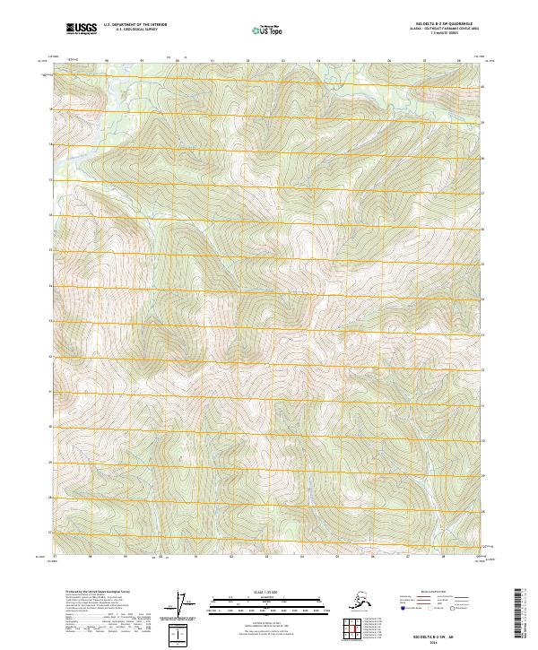
2024 Map of Big Delta B-2 SW
USGS Topo · Published 2024About this map
Goodpaster River winds through the northwestern corner of this interior Alaskan landscape, a region defined by high ridgelines and the seasonal drainages of the Central Creek and Big Swede Creek systems. The map depicts a rugged, unpopulated wilderness within the Southeast Fairbanks Census Area, where the topography rises sharply from the river valley into a complex network of summits. The drainage pattern of White Creek and its neighbors reveals a classic subarctic watershed, largely untouched by permanent road infrastructure or established settlements. This 2024 data represents the contemporary state of the t7s r14e and t7s r15e townships, providing a clear view of the natural terrain and watercourses that have shaped navigation and land use in the Big Delta region for generations.
Find a feature on this map
10 named features on this map. Tap any name to fly to it.
Don’t see what you’re looking for? This feature index may not catch every label — zoom into the map to look around manually.
Map Details
Editions of this 2024 Big Delta B-2 SW Map
This is the sole edition of this map. No revisions or reprints were ever made.
Other maps of this area

1950 · Big Delta
USGS Topo · 1:250,000

1951 · Big Delta
USGS Topo · 1:250,000

1954 · Big Delta A-2
USGS Topo · 1:63,360

1955 · Big Delta A-3
USGS Topo · 1:63,360

1955 · Big Delta A-2
USGS Topo · 1:63,360

1958 · Big Delta B-3
USGS Topo · 1:63,360

1958 · Big Delta B-2
USGS Topo · 1:63,360

1958 · Big Delta
USGS Topo · 1:250,000
2016 · Big Delta B-3 SE
USGS Topo · 1:25,000
2016 · Big Delta B-3 NE
USGS Topo · 1:25,000