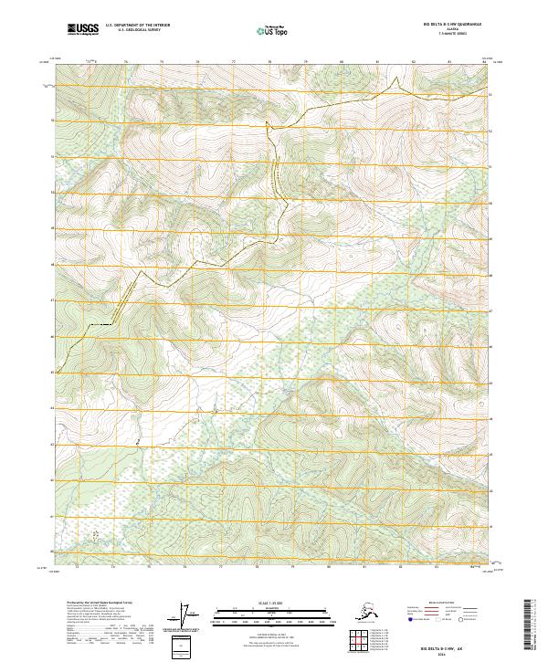
2024 Map of Big Delta B-3 NW
USGS Topo · Published 2024About this map
The South Fork Salcha River and the headwaters of Shaw Creek define this Interior Alaska landscape, where the meandering drainage patterns reveal a complex hydraulic network. The topographic detail highlights the jurisdictional boundary between the Fairbanks North Star Borough and the Southeast Fairbanks Census Area, tracing a line across the high ground between these two major water systems. This 2024 survey documents a wilderness area defined by significant relief, where the absence of roads or established settlements emphasizes the role of natural waterways as the primary geographic markers. The map provides a high-resolution look at the intricate contour lines and wetlands that characterize this portion of the Tanana Valley watershed, serving as a critical reference for understanding the physical geography of the region as it exists in the current decade.
Find a feature on this map
9 named features on this map. Tap any name to fly to it.
Don’t see what you’re looking for? This feature index may not catch every label — zoom into the map to look around manually.
Map Details
Editions of this 2024 Big Delta B-3 NW Map
This is the sole edition of this map. No revisions or reprints were ever made.
Other maps of this area

1950 · Big Delta
USGS Topo · 1:250,000

1950 · Big Delta B-4
USGS Topo · 1:63,360

1951 · Big Delta
USGS Topo · 1:250,000

1953 · Big Delta B-4
USGS Topo · 1:63,360

1958 · Big Delta C-4
USGS Topo · 1:63,360

1958 · Big Delta B-3
USGS Topo · 1:63,360

1958 · Big Delta C-3
USGS Topo · 1:63,360

1958 · Big Delta
USGS Topo · 1:250,000
2016 · Big Delta C-3 SE
USGS Topo · 1:25,000
2016 · Big Delta B-4 SE
USGS Topo · 1:25,000