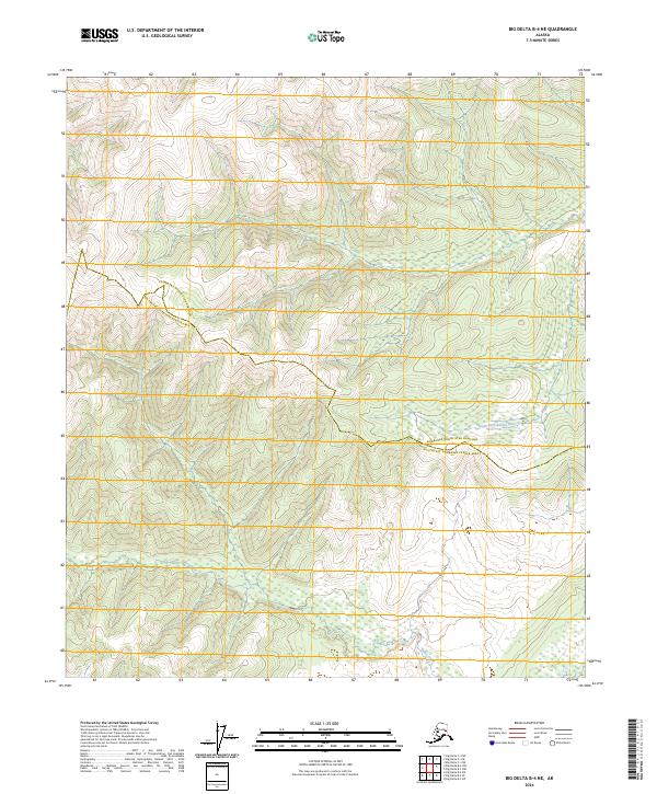
2024 Map of Big Delta B-4 NE
USGS Topo · Published 2024About this map
The South Fork Salcha River winds through the interior Alaskan wilderness in this contemporary topographic record of the borderlands between the Fairbanks North Star Borough and the Southeast Fairbanks Census Area. The landscape is defined by high elevation drainage patterns, with the northern reaches dominated by the river's upper watershed and the southern portion drained by the headwaters of Gilles Creek. Unlike more developed regions, this map reflects the vast, unsettled character of the Alaska interior, where the Public Land Survey System grids of t5s r11e and t6s r11e overlay a terrain devoid of roads or permanent structures. It offers a precise study of the natural topography and hydrologic features as they exist today in this remote section of the subarctic.
Find a feature on this map
7 named features on this map. Tap any name to fly to it.
Don’t see what you’re looking for? This feature index may not catch every label — zoom into the map to look around manually.
Map Details
Editions of this 2024 Big Delta B-4 NE Map
This is the sole edition of this map. No revisions or reprints were ever made.
Other maps of this area

1950 · Big Delta
USGS Topo · 1:250,000

1950 · Big Delta B-4
USGS Topo · 1:63,360

1951 · Big Delta
USGS Topo · 1:250,000

1953 · Big Delta B-4
USGS Topo · 1:63,360

1958 · Big Delta C-4
USGS Topo · 1:63,360

1958 · Big Delta B-3
USGS Topo · 1:63,360

1958 · Big Delta C-3
USGS Topo · 1:63,360

1958 · Big Delta
USGS Topo · 1:250,000
2016 · Big Delta B-4 SE
USGS Topo · 1:25,000
2016 · Big Delta C-4 SW
USGS Topo · 1:25,000