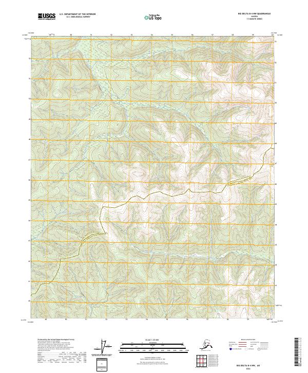
2024 Map of Big Delta B-4 NW
USGS Topo · Published 2024About this map
Flat Creek descends through the northwestern reaches of this interior Alaskan landscape, which remains largely defined by its natural drainage patterns and the administrative lines of the Fairbanks North Star Borough Southeast Fairbanks Census Area. The terrain is characterized by a network of waterways including McCoy Creek and Gilles Creek, which carve through the topographic contours of the Big Delta region. This 2024 edition reflects a modern snapshot of a vast wilderness area, where the primary human interventions are the historical Public Land Survey System township markers like t5s r9e and t6s r10e, rather than established settlements or roads. The map serves as a detailed study of hydrography and elevation in a portion of the state where the landscape is still primarily shaped by water and ice.
Find a feature on this map
8 named features on this map. Tap any name to fly to it.
Don’t see what you’re looking for? This feature index may not catch every label — zoom into the map to look around manually.
Map Details
Editions of this 2024 Big Delta B-4 NW Map
This is the sole edition of this map. No revisions or reprints were ever made.
Other maps of this area

1949 · Big Delta B-5
USGS Topo · 1:63,360

1950 · Big Delta
USGS Topo · 1:250,000

1950 · Big Delta B-4
USGS Topo · 1:63,360

1951 · Big Delta
USGS Topo · 1:250,000

1952 · Big Delta B-5
USGS Topo · 1:63,360

1953 · Big Delta B-4
USGS Topo · 1:63,360

1958 · Big Delta C-5
USGS Topo · 1:63,360

1958 · Big Delta C-4
USGS Topo · 1:63,360

1958 · Big Delta
USGS Topo · 1:250,000
2016 · Big Delta B-4 SE
USGS Topo · 1:25,000