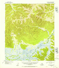
1953 Map of Big Delta B-4
USGS Topo · Published 1954About this map
The Shaw Creek Flats dominate the southern portion of this landscape, creating an expansive network of wetlands and braided watercourses. In the early 1950s, this region remained a wilderness of high peaks and drainage systems, defined by the major flow of Shaw Creek and its many tributaries. The topography rises sharply from the marshy lowlands into a series of prominent summits marked by triangulation stations, including VABM 4084 Mid and VABM 3570 Peak, which served as critical points for the Department of the Interior's surveying efforts.
Find a feature on this map
15 named features on this map. Tap any name to fly to it.
Don’t see what you’re looking for? This feature index may not catch every label — zoom into the map to look around manually.
Map Details
Editions of this 1953 Big Delta B-4 Map
2 editions found
Other maps of this area

1949 · Big Delta B-5
USGS Topo · 1:63,360

1950 · Big Delta
USGS Topo · 1:250,000

1950 · Big Delta A-5
USGS Topo · 1:63,360

1950 · Big Delta A-4
USGS Topo · 1:63,360

1950 · Big Delta B-4
USGS Topo · 1:63,360

1951 · Big Delta
USGS Topo · 1:250,000

1952 · Big Delta A-5
USGS Topo · 1:63,360

1952 · Big Delta A-4
USGS Topo · 1:63,360

1952 · Big Delta B-5
USGS Topo · 1:63,360

1953 · Big Delta B-4
USGS Topo · 1:63,360