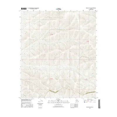
2016 Map of Big Delta B-5 NE
USGS Topo · Published 2016About this map
The Alaska Pipeline cuts a distinct path through the southwestern portion of this Alaskan interior landscape, crossing the drainage of Minton Cr as it moves toward the borough boundary. The map depicts a rugged watershed system defined by significant water bodies including Monte Cristo Cr and McCoy Cr, which carve deep drainage patterns through the high-elevation terrain. This 2016 survey illustrates the intersection of modern industrial infrastructure with the traditional physical geography of the region, marking the border between the Fairbanks North Star Borough and Southeast Fairbanks Census Area. The drainage network, featuring Uncle Sam Cr and Keystone Cr, highlights the natural corridors that have dictated movement and resource management in this part of the interior for decades.
Find a feature on this map
11 named features on this map. Tap any name to fly to it.
Don’t see what you’re looking for? This feature index may not catch every label — zoom into the map to look around manually.
Map Details
Editions of this 2016 Big Delta B-5 NE Map
This is the sole edition of this map. No revisions or reprints were ever made.
Other maps of this area

1949 · Big Delta B-5
USGS Topo · 1:63,360

1950 · Big Delta
USGS Topo · 1:250,000

1950 · Big Delta B-4
USGS Topo · 1:63,360

1951 · Big Delta
USGS Topo · 1:250,000

1952 · Big Delta B-5
USGS Topo · 1:63,360

1953 · Big Delta B-4
USGS Topo · 1:63,360

1958 · Big Delta C-5
USGS Topo · 1:63,360

1958 · Big Delta C-4
USGS Topo · 1:63,360

1958 · Big Delta
USGS Topo · 1:250,000
2016 · Big Delta B-5 SW
USGS Topo · 1:25,000