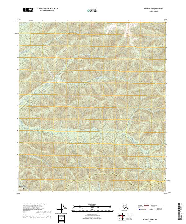
2024 Map of Big Delta B-5 NE
USGS Topo · Published 2024About this map
The Alaska Pipeline cuts through the southwestern corner of this landscape, marking a modern industrial corridor through the interior wilderness southeast of Fairbanks. The terrain is defined by a dense network of watercourses, including the westward-flowing McCoy Creek and Monte Cristo Creek, which drain the uplands. Near the southern boundary, the settlement of Harding-Birch Lakes borders the jurisdictional line between the Fairbanks North Star Borough and the Southeast Fairbanks Census Area. This topographic study reveals the complex drainage patterns of Uncle Sam Creek and Keystone Creek as they navigate the ridges and valleys of the Tanana River watershed, illustrating the intersection of large-scale energy infrastructure with a largely roadless environment.
Find a feature on this map
13 named features on this map. Tap any name to fly to it.
Don’t see what you’re looking for? This feature index may not catch every label — zoom into the map to look around manually.
Map Details
Editions of this 2024 Big Delta B-5 NE Map
This is the sole edition of this map. No revisions or reprints were ever made.
Other maps of this area

1949 · Big Delta B-5
USGS Topo · 1:63,360

1950 · Big Delta
USGS Topo · 1:250,000

1950 · Big Delta B-4
USGS Topo · 1:63,360

1951 · Big Delta
USGS Topo · 1:250,000

1952 · Big Delta B-5
USGS Topo · 1:63,360

1953 · Big Delta B-4
USGS Topo · 1:63,360

1958 · Big Delta C-5
USGS Topo · 1:63,360

1958 · Big Delta C-4
USGS Topo · 1:63,360

1958 · Big Delta
USGS Topo · 1:250,000
2016 · Big Delta B-5 SW
USGS Topo · 1:25,000