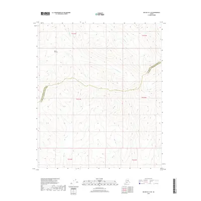
2018 Map of Big Delta C-2 SW
USGS Topo · Published 2018About this map
The Mertie Mountains dominate this high-latitude terrain, where the landscape is defined by the complex drainage patterns of the interior. The survey documents a network of alpine streams, including the headwaters of Upper Boulder Cr and Lower Boulder Cr, which carve through the steep elevations. Further south, the flow of Indian Cr and the presence of Glacier Cr indicate the glacial history and cold-water hydrology typical of this portion of the Unorganized Borough. This 2018 edition reveals a wilderness largely devoid of modern infrastructure, preserving the raw topography of the boundary between the Fairbanks North Star Borough and Southeast Fairbanks Census Area. The alignment of Camp Cr and other tributaries provides a clear look at the structural geology of these northern ranges.
Find a feature on this map
13 named features on this map. Tap any name to fly to it.
Don’t see what you’re looking for? This feature index may not catch every label — zoom into the map to look around manually.
Map Details
Editions of this 2018 Big Delta C-2 SW Map
This is the sole edition of this map. No revisions or reprints were ever made.
Other maps of this area

1950 · Big Delta
USGS Topo · 1:250,000

1951 · Big Delta
USGS Topo · 1:250,000

1958 · Big Delta B-3
USGS Topo · 1:63,360

1958 · Big Delta C-3
USGS Topo · 1:63,360

1958 · Big Delta B-2
USGS Topo · 1:63,360

1958 · Big Delta C-2
USGS Topo · 1:63,360

1958 · Big Delta
USGS Topo · 1:250,000
2016 · Big Delta C-3 SE
USGS Topo · 1:25,000
2016 · Big Delta B-3 NE
USGS Topo · 1:25,000
2016 · Big Delta C-3 NE
USGS Topo · 1:25,000