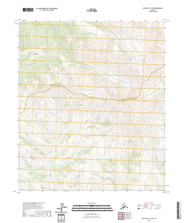
2024 Map of Big Delta C-2 SW
USGS Topo · Published 2024About this map
The Mertie Mountains dominate the northwestern portion of this 2024 landscape, defining a high-elevation interior where drainage patterns dictate the geography. The high ridges of these mountains shed water into several distinct systems, including the westward-flowing Camp Creek and the southern reach of Indian Creek. The area is bisected by the boundary between the Fairbanks North Star Borough and Southeast Fairbanks Census Area, a line that cuts across the high country between Lower Boulder Creek and the headwaters of Glacier Creek. This contemporary survey illustrates the complex topography and drainage network of the Alaska interior, highlighting the relationship between the Upper Boulder Creek valley and the surrounding peaks within the Fairbanks and Southeast Fairbanks districts.
Find a feature on this map
13 named features on this map. Tap any name to fly to it.
Don’t see what you’re looking for? This feature index may not catch every label — zoom into the map to look around manually.
Map Details
Editions of this 2024 Big Delta C-2 SW Map
This is the sole edition of this map. No revisions or reprints were ever made.
Other maps of this area

1950 · Big Delta
USGS Topo · 1:250,000

1951 · Big Delta
USGS Topo · 1:250,000

1958 · Big Delta B-3
USGS Topo · 1:63,360

1958 · Big Delta C-3
USGS Topo · 1:63,360

1958 · Big Delta B-2
USGS Topo · 1:63,360

1958 · Big Delta C-2
USGS Topo · 1:63,360

1958 · Big Delta
USGS Topo · 1:250,000
2016 · Big Delta C-3 SE
USGS Topo · 1:25,000
2016 · Big Delta B-3 NE
USGS Topo · 1:25,000
2016 · Big Delta C-3 NE
USGS Topo · 1:25,000