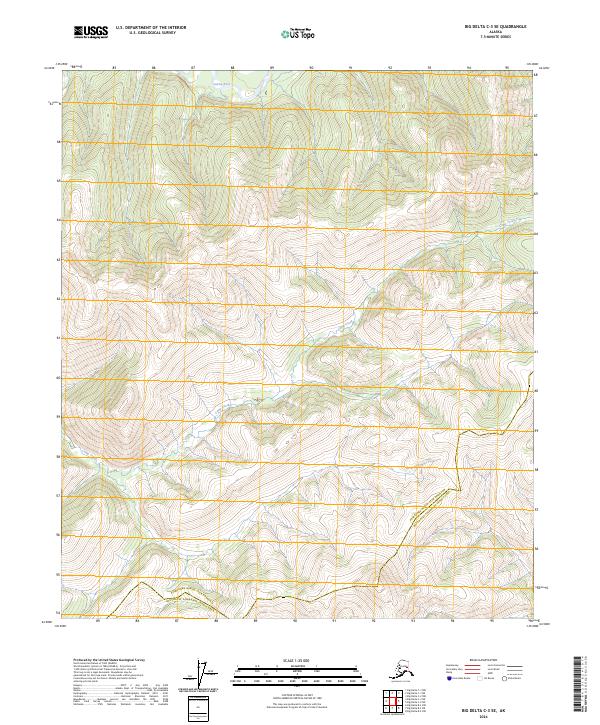
2024 Map of Big Delta C-3 SE
USGS Topo · Published 2024About this map
The Salcha River flows through the northern reaches of this Alaskan interior landscape, a region defined by high ridges and complex drainage systems. Much of the map's character is shaped by the winding course of Camp Creek, which cuts through the central and southern terrain. This 2024 survey documents the boundary line of the Fairbanks North Star Borough Southeast Fairbanks Census Area, tracing the division between these two administrative regions across the high country. The landscape is largely undeveloped, represented by intricate contour intervals that reveal a network of unnamed peaks and steep valleys characteristic of the Tanana Valley watershed. For researchers, this document provides a precise modern baseline of the topography and watercourses before further human expansion or environmental change alters the drainages feeding into the greater Tanana River system.
Find a feature on this map
11 named features on this map. Tap any name to fly to it.
Don’t see what you’re looking for? This feature index may not catch every label — zoom into the map to look around manually.
Map Details
Editions of this 2024 Big Delta C-3 SE Map
This is the sole edition of this map. No revisions or reprints were ever made.
Other maps of this area

1950 · Big Delta
USGS Topo · 1:250,000

1951 · Big Delta
USGS Topo · 1:250,000

1958 · Big Delta B-3
USGS Topo · 1:63,360

1958 · Big Delta C-3
USGS Topo · 1:63,360

1958 · Big Delta B-2
USGS Topo · 1:63,360

1958 · Big Delta C-2
USGS Topo · 1:63,360

1958 · Big Delta
USGS Topo · 1:250,000
2016 · Big Delta C-3 SE
USGS Topo · 1:25,000
2016 · Big Delta C-3 NW
USGS Topo · 1:25,000
2016 · Big Delta B-3 NE
USGS Topo · 1:25,000