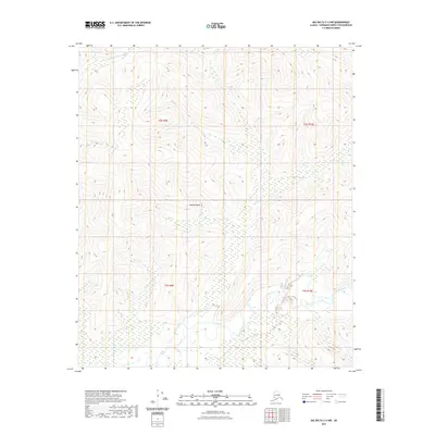
2021 Map of Big Delta C-4 NW
USGS Topo · Published 2021About this map
The Salcha River corridor and the drainage of the S Fork Chena River define this interior Alaskan landscape. Dominated by high-relief terrain and a complex system of waterways, the area is centered around the prominent Marshall Mtn. The hydrology of the region is further detailed by the courses of Butte Cr and Deep Cr, which cut through the hills south of the S Fork Chena River. This 2021 survey demonstrates the stark, uninhabited nature of the Fairbanks North Star Borough's remote interior, where the land is primarily organized by the Public Land Survey System grids of t2s r9e, t2s r10e, t3s r9e, and t3s r10e. This specific cartography is essential for understanding the natural water systems that flow between two of the region's major river basins.
Find a feature on this map
9 named features on this map. Tap any name to fly to it.
Don’t see what you’re looking for? This feature index may not catch every label — zoom into the map to look around manually.
Map Details
Editions of this 2021 Big Delta C-4 NW Map
This is the sole edition of this map. No revisions or reprints were ever made.
Other maps of this area

1950 · Big Delta
USGS Topo · 1:250,000

1951 · Big Delta
USGS Topo · 1:250,000

1958 · Big Delta C-5
USGS Topo · 1:63,360

1958 · Big Delta D-5
USGS Topo · 1:63,360

1958 · Big Delta C-4
USGS Topo · 1:63,360

1958 · Big Delta D-4
USGS Topo · 1:63,360

1958 · Big Delta
USGS Topo · 1:250,000
2016 · Big Delta D-4 SE
USGS Topo · 1:25,000
2016 · Big Delta C-4 SW
USGS Topo · 1:25,000
2016 · Big Delta C-5 NE
USGS Topo · 1:25,000