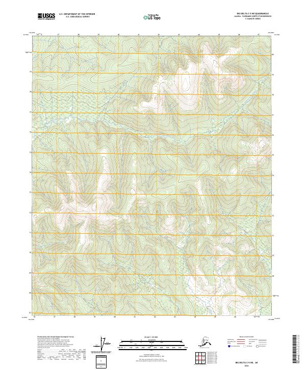
2024 Map of Big Delta C-5 NE
USGS Topo · Published 2024About this map
South Fork Chena River winds across the interior Alaskan landscape in this survey of the Fairbanks North Star Borough. The map documents the complex drainage patterns of the high country, where the river's path is defined by steep terrain and narrow valleys. To the north, Beaver Creek and its tributary Wheeler Creek carve through the northern sections of the quadrangle. This 2024 edition is focused on the natural hydrography and public land divisions, specifically detailing portions of t2s r8e and t3s r8e. The absence of developed roads or named settlements emphasizes the wilderness character of this region northeast of Big Delta, offering researchers a look at the untouched drainage systems of the Yukon-Tanana Uplands.
Find a feature on this map
9 named features on this map. Tap any name to fly to it.
Don’t see what you’re looking for? This feature index may not catch every label — zoom into the map to look around manually.
Map Details
Editions of this 2024 Big Delta C-5 NE Map
This is the sole edition of this map. No revisions or reprints were ever made.
Other maps of this area

1950 · Big Delta
USGS Topo · 1:250,000

1951 · Big Delta
USGS Topo · 1:250,000

1958 · Big Delta C-5
USGS Topo · 1:63,360

1958 · Big Delta D-5
USGS Topo · 1:63,360

1958 · Big Delta C-4
USGS Topo · 1:63,360

1958 · Big Delta D-4
USGS Topo · 1:63,360

1958 · Big Delta
USGS Topo · 1:250,000
2016 · Big Delta C-5 NW
USGS Topo · 1:25,000
2016 · Big Delta C-4 SW
USGS Topo · 1:25,000
2016 · Big Delta C-5 NE
USGS Topo · 1:25,000