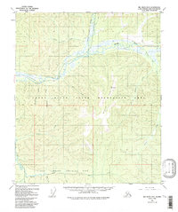
1958 Map of Big Delta D-5
USGS Topo · Published 1992About this map
The Chena River flows through this interior landscape, which in the late 1950s served as a crossroads for military training and burgeoning state land management. The northern half of the map is dominated by the Chena River State Recreation Area, where the Middle Fork and Stiles Creek converge. A persistent Tractor Trail provides the primary overland route through the valley, passing remote cabins and the prominent Tors rock formations. To the south, the Yukon Command Training Site marks a significant Cold War military footprint along Beaver Creek. This area of the Fairbanks North Star Borough reveals a landscape defined by its drainage basins, including Munson Creek and Mastadon Creek, and small remnants of earlier activity such as Ruins near the southern boundary.
Find a feature on this map
25 named features on this map. Tap any name to fly to it.
Don’t see what you’re looking for? This feature index may not catch every label — zoom into the map to look around manually.
Map Details
Editions of this 1958 Big Delta D-5 Map
4 editions found

Other maps of this area

1949 · Big Delta C-6
USGS Topo · 1:63,360

1950 · Big Delta
USGS Topo · 1:250,000

1950 · Big Delta D-6
USGS Topo · 1:63,360

1951 · Big Delta
USGS Topo · 1:250,000

1951 · Circle
USGS Topo · 1:250,000

1951 · Circle A-5
USGS Topo · 1:63,360

1952 · Big Delta C-6
USGS Topo · 1:63,360

1952 · Big Delta D-6
USGS Topo · 1:63,360

1952 · Circle A-4
USGS Topo · 1:63,360

1952 · Circle A-5
USGS Topo · 1:63,360