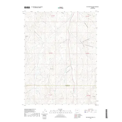
2019 Map of Big Foundation Creek
USGS Topo · Published 2019About this map
Oil Spring Mtn and Twin Buttes anchor this high-elevation landscape along the boundary of Rio Blanco and Garfield counties. This 2019 survey captures a complex network of drainages and canyons that define the region's topography, including Red Rock Canyon and the deep Round Mountain Canyon. The map reveals a land structured by its watercourses, where Big Foundation Creek and Little Foundation Cr converge near Big Foundation Cr Rd. Modern infrastructure is represented by Route 139 and Douglas Pass Rd, which provide access through the difficult terrain of Wolf Canyon and Sawmill Canyon. The presence of Mail Box Draw and Texas Draw suggests the ongoing importance of access routes in this sparsely settled portion of the Colorado backcountry.
Find a feature on this map
30 named features on this map. Tap any name to fly to it.
Don’t see what you’re looking for? This feature index may not catch every label — zoom into the map to look around manually.
Map Details
Editions of this 2019 Big Foundation Creek Map
This is the sole edition of this map. No revisions or reprints were ever made.
Other maps of this area

1956 · Grand Junction
USGS Topo · 1:250,000

1959 · Grand Junction
USGS Topo · 1:250,000

1960 · Grand Junction
USGS Topo · 1:250,000

1962 · Grand Junction
USGS Topo · 1:250,000

1964 · Grand Junction
USGS Topo · 1:250,000

1964 · Texas Creek
USGS Topo · 1:24,000

1964 · Douglas Pass
USGS Topo · 1:24,000

1964 · Brushy Point
USGS Topo · 1:24,000

1964 · East Evacuation Creek
USGS Topo · 1:24,000
1964 · White Coyote Draw
USGS Topo · 1:24,000