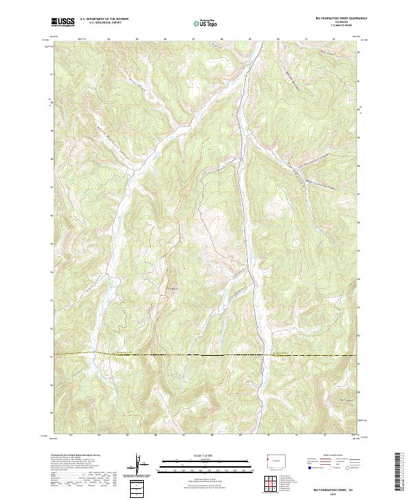
2022 Map of Big Foundation Creek
USGS Topo · Published 2022About this map
The high plateau country of western Colorado is defined here by the meeting of Rio Blanco and Garfield counties, where the drainage network of the Piceance Basin carves deep into the landscape. Twin Buttes stands as a prominent landmark amidst a complex series of canyons including Round Mountain Canyon and Wolf Canyon. These drainages feed into the larger system of Big Foundation Cr and W Douglas Cr, reflecting a terrain shaped by seasonal water and high-elevation erosion.
Find a feature on this map
29 named features on this map. Tap any name to fly to it.
Don’t see what you’re looking for? This feature index may not catch every label — zoom into the map to look around manually.
Map Details
Editions of this 2022 Big Foundation Creek Map
This is the sole edition of this map. No revisions or reprints were ever made.
Other maps of this area

1956 · Grand Junction
USGS Topo · 1:250,000

1959 · Grand Junction
USGS Topo · 1:250,000

1960 · Grand Junction
USGS Topo · 1:250,000

1962 · Grand Junction
USGS Topo · 1:250,000

1964 · Grand Junction
USGS Topo · 1:250,000

1964 · Texas Creek
USGS Topo · 1:24,000

1964 · Douglas Pass
USGS Topo · 1:24,000

1964 · Brushy Point
USGS Topo · 1:24,000

1964 · East Evacuation Creek
USGS Topo · 1:24,000
1964 · White Coyote Draw
USGS Topo · 1:24,000