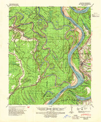
1939 Map of Big Island
USGS Topo · Published 1954About this map
The Mississippi River and Arkansas River converge in this complex riverine landscape, where the shifting currents of the delta have carved a labyrinth of oxbows and islands. At the heart of the map lies Big Island, a massive tract of alluvial land bounded by the White River and the main channel. The river-and-rail economy of the 1930s is evident in the numerous landings such as Hopedale Ldg, Riverton Ldg, and Napoleon Ldg, many of which served as vital collection points for cotton and timber before the expansion of modern highways.
Find a feature on this map
74 named features on this map. Tap any name to fly to it.
Don’t see what you’re looking for? This feature index may not catch every label — zoom into the map to look around manually.
Map Details
Editions of this 1939 Big Island Map
3 editions found
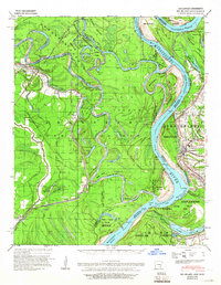
Other maps of this area

1930 · Mellwood
USGS Topo · 1:62,500

1933 · Lamont
USGS Topo · 1:62,500

1935 · Red Fork
USGS Topo · 1:62,500

1935 · Gillett
USGS Topo · 1:62,500

1936 · McGehee
USGS Topo · 1:62,500

1937 · McGehee
USGS Topo · 1:62,500

1939 · Henrico
USGS Topo · 1:62,500

1939 · Pace
USGS Topo · 1:62,500

1939 · Big Island
USGS Topo · 1:62,500

1939 · Mellwood
USGS Topo · 1:62,500