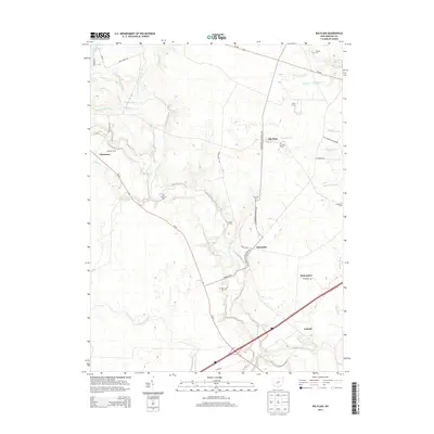
2013 Map of Big Plain
USGS Topo · Published 2013About this map
Deer Creek and its many tributary ditches, including Van Cleve Ditch and Chrisman Ditch, form the primary drainage system through this agricultural portion of Madison County. The landscape is defined by the persistence of small, unincorporated communities like Big Plain and Kiousville, which serve as anchors for the surrounding farmsteads. Family and community heritage is deeply etched into the land through numerous small burial grounds such as Timmons Cem, Graham Cem, and Dennison Cem, often located near the winding path of Bradford Creek.
Find a feature on this map
44 named features on this map. Tap any name to fly to it.
Don’t see what you’re looking for? This feature index may not catch every label — zoom into the map to look around manually.
Map Details
Editions of this 2013 Big Plain Map
This is the sole edition of this map. No revisions or reprints were ever made.
Other maps of this area

1906 · Mt Sterling
USGS Topo · 1:62,500

1907 · London
USGS Topo · 1:62,500

1911 · Era
USGS Topo · 1:62,500

1913 · Era
USGS Topo · 1:62,500

1923 · West Columbus
USGS Topo · 1:62,500

1925 · West Columbus
USGS Topo · 1:62,500

1943 · Era
USGS Topo · 1:62,500

1947 · Columbus
USGS Topo · 1:250,000

1955 · Harrisburg
USGS Topo · 1:24,000
1955 · Galloway
USGS Topo · 1:24,000