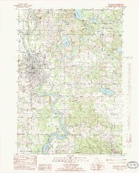
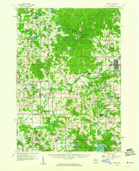
1985 Map of Big Rapids
USGS Topo · Published 1985About this map
The Muskegon River meanders through this landscape, defining the character of Big Rapids as it flows south toward Rogers Pond and the Rogers Dam. In the mid-1980s, the expansion of Ferris State College and the infrastructure of the Roben-Hood Airport mark the city's growth, while an Old RR Grade cutting through the terrain hints at the region's earlier industrial transit. To the northeast, the Haymarsh Lake State Game Area preserves a dense network of water bodies, including Young Lake and Bergess Lake, contrasting the urban development with managed wildlands. Small outlying settlements like Byers and Ryan appear alongside numerous Gravel Pits, illustrating the local extraction and rural settlement patterns that persist away from the main river corridor.
Find a feature on this map
42 named features on this map. Tap any name to fly to it.
Don’t see what you’re looking for? This feature index may not catch every label — zoom into the map to look around manually.
Map Details
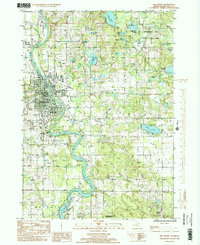
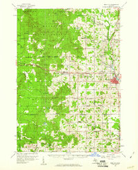
Editions of this 1985 Big Rapids Map
2 editions found
Other maps of this area

1954 · Midland
USGS Topo · 1:250,000

1958 · Midland
USGS Topo · 1:250,000
1958 · Woodville
USGS Topo · 1:62,500
1958 · Big Rapids
USGS Topo · 1:62,500

1959 · Midland
USGS Topo · 1:250,000
1959 · Evart
USGS Topo · 1:62,500
1959 · Reed City
USGS Topo · 1:62,500

1966 · Midland
USGS Topo · 1:250,000
1976 · Big Rapids SE
USGS Topo · 1:24,000

1976 · Evart SW
USGS Topo · 1:24,000
Featured Places
- Big Rapids, MI
- Big Rapids Township, MI
- Austin Township, MI
- Mecosta Township, MI
- Green Charter Township, MI