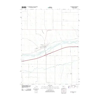
2010 Map of Big Springs
USGS Topo · Published 2010About this map
The South Platte River carves a diagonal path through this 2010 landscape, dictating the development of transport and irrigation in this Nebraska-Colorado border region. The town of Big Springs serves as a central hub, situated near the Big Springs Post Office and the Big Springs Cemetery. This area reflects the intersection of essential infrastructure and natural topography, where the Western Canal draws water from the river to support the surrounding agricultural plains. The road network is highly structured, with designations like Road West 80 and Road West 50 framing the grid. Local landmarks such as Trailer House Gulch and Goldeneye Lake provide specific geographic markers, while Newman Airport to the southeast indicates the continued importance of regional transit connections in the modern era.
Find a feature on this map
30 named features on this map. Tap any name to fly to it.
Don’t see what you’re looking for? This feature index may not catch every label — zoom into the map to look around manually.
Map Details
Editions of this 2010 Big Springs Map
This is the sole edition of this map. No revisions or reprints were ever made.
Other maps of this area

1897 · Ogallala
USGS Topo · 1:125,000

1900 · Chappell
USGS Topo · 1:125,000

1900 · Ogallala
USGS Topo · 1:125,000

1954 · Sterling
USGS Topo · 1:250,000

1954 · Scottsbluff
USGS Topo · 1:250,000

1954 · McCook
USGS Topo · 1:250,000

1954 · North Platte
USGS Topo · 1:250,000

1956 · North Platte
USGS Topo · 1:250,000

1957 · North Platte
USGS Topo · 1:250,000

1957 · McCook
USGS Topo · 1:250,000