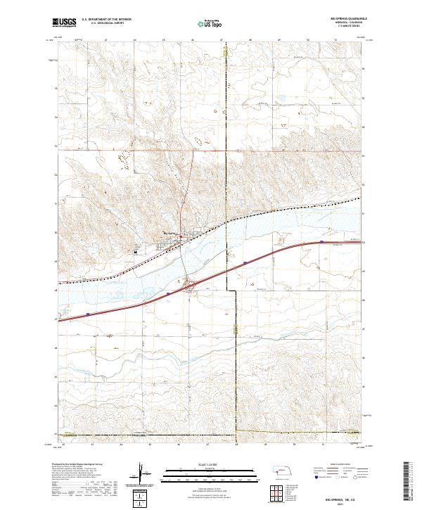
2021 Map of Big Springs
USGS Topo · Published 2021About this map
Big Springs sits at a geographic crossroads where the South Platte River and the Western Canal define the irrigation and transport corridor of the Nebraska-Colorado borderlands. The town's grid is anchored by Railroad St, signaling the historic importance of the rail line that follows the river valley through this portion of Deuel County. North of the settlement, the terrain transitions into the draw of Trailer House Gulch, surrounded by a high-plains landscape marked by a strict section-line road network including Circle Rd and various numbered routes. Genealogists will find the Big Spring Cem located just south of the primary townsite, overlooking the river bottom. This 2021 survey also documents the precise jurisdictional meeting of Deuel, Keith, Perkins, and Sedgwick counties, where the state line divides the agricultural plains of Nebraska from the Colorado panhandle.
Find a feature on this map
34 named features on this map. Tap any name to fly to it.
Don’t see what you’re looking for? This feature index may not catch every label — zoom into the map to look around manually.
Map Details
Editions of this 2021 Big Springs Map
This is the sole edition of this map. No revisions or reprints were ever made.
Other maps of this area

1897 · Ogallala
USGS Topo · 1:125,000

1900 · Chappell
USGS Topo · 1:125,000

1900 · Ogallala
USGS Topo · 1:125,000

1954 · Sterling
USGS Topo · 1:250,000

1954 · Scottsbluff
USGS Topo · 1:250,000

1954 · McCook
USGS Topo · 1:250,000

1954 · North Platte
USGS Topo · 1:250,000

1956 · North Platte
USGS Topo · 1:250,000

1957 · North Platte
USGS Topo · 1:250,000

1957 · McCook
USGS Topo · 1:250,000