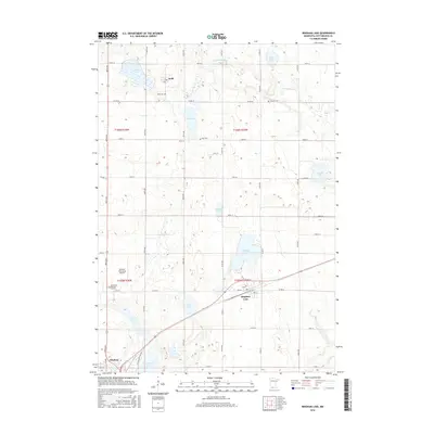
2016 Map of Bingham Lake
USGS Topo · Published 2016About this map
The Watonwan River threads through this corner of Cottonwood County, where the prairie landscape is punctuated by a dense concentration of glacial lakes and wetlands. The settlement of Bingham Lake sits at the junction of several regional routes, including Co Rd 44 and Co Rd 47, positioned near the water body of the same name. To the northwest, the small community of Delft serves as a local landmark, accompanied by the Delft Cem.
Find a feature on this map
35 named features on this map. Tap any name to fly to it.
Don’t see what you’re looking for? This feature index may not catch every label — zoom into the map to look around manually.
Map Details
Editions of this 2016 Bingham Lake Map
This is the sole edition of this map. No revisions or reprints were ever made.
Other maps of this area

1953 · New Ulm
USGS Topo · 1:250,000

1954 · Fairmont
USGS Topo · 1:250,000

1957 · New Ulm
USGS Topo · 1:250,000

1958 · New Ulm
USGS Topo · 1:250,000

1958 · Fairmont
USGS Topo · 1:250,000

1967 · New Ulm
USGS Topo · 1:250,000

1967 · Sanborn SE
USGS Topo · 1:24,000

1967 · Jeffers
USGS Topo · 1:24,000
1967 · Comfrey
USGS Topo · 1:24,000
1970 · Bingham Lake
USGS Topo · 1:24,000