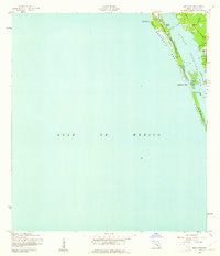
1944 Map of Bird Keys
USGS Topo · Published 1961About this map
Sarasota Key and Casey Key dominate this wartime coastal survey, showing the barrier island geography before mid-century development transformed the Florida shoreline. Separated from the mainland by the waters of Little Sarasota Bay, these keys are characterized by natural features like the prominent Point O'Rocks and White Beach. Near the southern end of Sarasota Key, the small islands of the Bird Keys sit adjacent to Musketeers Pass, a navigable opening to the Gulf of Mexico. On the mainland, the settlement of Vamo is one of the few established communities captured during this period, providing a rare look at the area's early 1940s footprint. The map, based on 1942 aerial photography, preserves the original shoreline and drainage patterns of the Sarasota coast before modern dredging and urbanization altered the landscape.
Find a feature on this map
10 named features on this map. Tap any name to fly to it.
Don’t see what you’re looking for? This feature index may not catch every label — zoom into the map to look around manually.
Map Details
Editions of this 1944 Bird Keys Map
2 editions found
Other maps of this area

1943 · Laurel
USGS Topo · 1:24,000

1944 · Bird Keys
USGS Topo · 1:31,680

1944 · Sarasota
USGS Topo · 1:31,680

1944 · Laurel
USGS Topo · 1:31,680

1944 · Venice
USGS Topo · 1:31,680

1947 · Bee Ridge
USGS Topo · 1:24,000

1956 · Tampa
USGS Topo · 1:250,000

1959 · Tampa
USGS Topo · 1:250,000

1960 · Tampa
USGS Topo · 1:250,000

1972 · Tampa
USGS Topo · 1:250,000