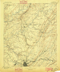
1953 Map of Birmingham
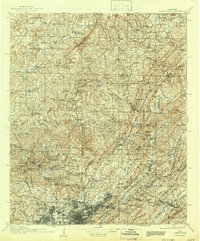
USGS Topo · Published 1973About this map
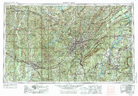
The industrial heart of Alabama centers on the dense urban corridor of Birmingham and Bessemer, where the terrain of Red Mountain and Shades Mountain defines the expansion of suburbs like Mountain Brook and Vestavia Hills. This survey captures the region's complex geography during a period of significant post-war development, showing the heavy reliance on a dense rail network including the Southern Ry and Louisville and Nashville RR. To the west, the Black Warrior River serves as a primary artery near Tuscaloosa and Northport, while the northeast is anchored by Gadsden and the military presence at Fort McClellan Military Reservation. The map details a landscape transition from coal and iron mining operations to vast natural tracts like the William B. Bankhead National Forest and the Talladega National Forest, illustrating the state's dual identity as an industrial powerhouse and a timber-rich wilderness.
Find a feature on this map
239 named features on this map. Tap any name to fly to it.
Don’t see what you’re looking for? This feature index may not catch every label — zoom into the map to look around manually.
Map Details
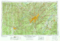
Editions of this 1953 Birmingham Map
4 editions found

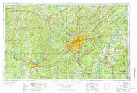
Historical Maps of Birmingham Through Time
7 maps found