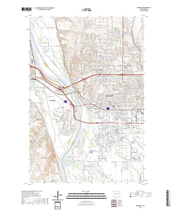
2024 Map of Bismarck
USGS Topo · Published 2024About this map
The Missouri River serves as the dividing line between the cities of Bismarck and Mandan in this contemporary overview of the North Dakota state capital. The landscape is heavily marked by institutional and commemorative sites, from the North Dakota Supreme Court and Burleigh County Courthouse downtown to the numerous resting places that ring the urban area, including Mandan Union Cem, Greenwood Cem, and the sprawling North Dakota Veterans Cem to the south. Educational centers like Bismarck State College and the United Tribes Technical College are central to the city's modern layout.
Find a feature on this map
66 named features on this map. Tap any name to fly to it.
Don’t see what you’re looking for? This feature index may not catch every label — zoom into the map to look around manually.
Map Details
Editions of this 2024 Bismarck Map
This is the sole edition of this map. No revisions or reprints were ever made.
Other maps of this area

1907 · Bismarck
USGS Topo · 1:125,000

1950 · Bismarck
USGS Topo · 1:24,000

1951 · Menoken SW
USGS Topo · 1:24,000

1951 · Bismarck
USGS Topo · 1:62,500

1951 · Mandan
USGS Topo · 1:24,000

1951 · Menoken
USGS Topo · 1:62,500

1954 · Bismarck
USGS Topo · 1:250,000

1958 · Bismarck
USGS Topo · 1:250,000

1962 · Sugarloaf Butte
USGS Topo · 1:24,000

1962 · Schmidt
USGS Topo · 1:24,000