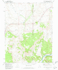
1970 Map of Bitter Creek Well
USGS Topo · Published 1980About this map
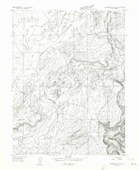
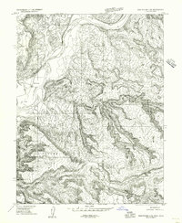
Bitter Creek Well (Flowing) stands as a focal point in this 1970 landscape, where the high desert terrain of Eastern Utah meets the Colorado border. The map reveals a complex network of resource extraction and transit, evidenced by numerous Drill Holes and an extensive Pipeline cutting through the arid topography. The geological character is defined by landmarks like Castle Rocks and the deep incisions of Rabbit Valley, which lead toward the southern boundary along the Colorado River.
Find a feature on this map
21 named features on this map. Tap any name to fly to it.
Don’t see what you’re looking for? This feature index may not catch every label — zoom into the map to look around manually.
Map Details
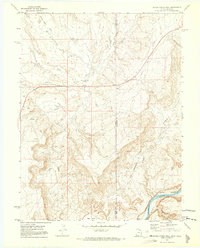
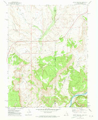
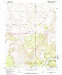
Editions of this 1970 Bitter Creek Well Map
4 editions found
Other maps of this area

1885 · East Tavaputs
USGS Topo · 1:250,000
1954 · Westwater 4 SW
USGS Topo · 1:24,000
1956 · Westwater 4 SE
USGS Topo · 1:24,000

1956 · Grand Junction
USGS Topo · 1:250,000

1959 · Grand Junction
USGS Topo · 1:250,000

1960 · Grand Junction
USGS Topo · 1:250,000

1962 · Grand Junction
USGS Topo · 1:250,000

1964 · Grand Junction
USGS Topo · 1:250,000

1965 · Grand Junction
USGS Topo · 1:250,000

1968 · Badger Wash
USGS Topo · 1:24,000