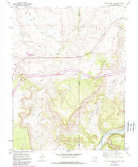
1970 Map of Bitter Creek Well
USGS Topo · Published 1987About this map
Bitter Creek Well (Flowing) and the high desert terrain of the Utah-Colorado border define this 1970 landscape, where resource extraction and transportation corridors intersect. The map documents an era of infrastructure development across the arid borderlands, featuring a prominent Pipeline and numerous Drill Holes scattered across the northern washes. This industrial activity contrasts with the older transit history represented by the Old Railroad Grade and the active Denver and Rio Grande Western Railroad winding through the southern canyonlands.
Find a feature on this map
22 named features on this map. Tap any name to fly to it.
Don’t see what you’re looking for? This feature index may not catch every label — zoom into the map to look around manually.
Map Details
Editions of this 1970 Bitter Creek Well Map
4 editions found
Other maps of this area

1885 · East Tavaputs
USGS Topo · 1:250,000

1954 · Westwater 4 SW
USGS Topo · 1:24,000

1956 · Westwater 4 SE
USGS Topo · 1:24,000

1956 · Grand Junction
USGS Topo · 1:250,000

1959 · Grand Junction
USGS Topo · 1:250,000

1960 · Grand Junction
USGS Topo · 1:250,000

1962 · Grand Junction
USGS Topo · 1:250,000

1964 · Grand Junction
USGS Topo · 1:250,000

1965 · Grand Junction
USGS Topo · 1:250,000

1968 · Badger Wash
USGS Topo · 1:24,000