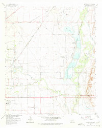
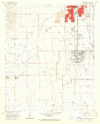
1962 Map of Bitter Lake
USGS Topo · Published 1975About this map
The Pecos River and Bitter Lake dominate this high-desert landscape northeast of Roswell, where the hydrology of the Pecos Valley is meticulously documented. The map details the complex water management systems of the early 1960s, including the Hagerman Canal, Garrod Dam, and a Salt Water Conversion Plant near the Rio Hondo. This era shows the convergence of traditional agriculture and mid-century industry, with the South Bitter Lake Oil Field operating alongside the Bitter Lake National Wildlife Refuge. Transportation infrastructure is anchored by the Atchison Topeka and Santa Fe railroad line running through the siding at Poe. On the outskirts of Roswell, civic life is represented by the Roswell Country Club, St Marys Cem, and several local schools, while the surrounding terrain rises toward Comanche Hill to the east.
Find a feature on this map
38 named features on this map. Tap any name to fly to it.
Don’t see what you’re looking for? This feature index may not catch every label — zoom into the map to look around manually.
Map Details
Editions of this 1962 Bitter Lake Map
4 editions found
Other maps of this area

1949 · Roswell North
USGS Topo · 1:24,000

1949 · Roswell South
USGS Topo · 1:24,000

1950 · Comanche Spring
USGS Topo · 1:24,000

1950 · Bottomless Lakes
USGS Topo · 1:24,000

1950 · South Spring
USGS Topo · 1:24,000

1950 · Bitter Lake
USGS Topo · 1:24,000

1955 · Roswell
USGS Topo · 1:250,000

1958 · Roswell
USGS Topo · 1:250,000

1962 · Roswell
USGS Topo · 1:250,000
1962 · Roswell South
USGS Topo · 1:24,000