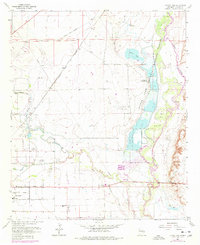
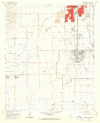
1962 Map of Bitter Lake
USGS Topo · Published 1977About this map
The Bitter Lake National Wildlife Refuge anchors the landscape where the Pecos River floodplain meets the Chaves County desert. This mid-century survey illustrates the vital management of water and minerals in the arid Pecos Valley, from the early Salt Water Conversion Plant to the extensive South Bitter Lake Oil Field. The northeast section of Roswell is visible, showing the expansion of the city through residential streets like Alameda Street and the Roswell Country Club. To the north, the small siding of Poe sits along the Atchison Topeka and Santa Fe railroad, reflecting the region's historic dependence on rail for shipping. The complex hydrology of the area is well-documented, featuring the Hagerman Canal, Garrod Dam, and the convergence of Berrendo Creek with the Rio Hondo.
Find a feature on this map
44 named features on this map. Tap any name to fly to it.
Don’t see what you’re looking for? This feature index may not catch every label — zoom into the map to look around manually.
Map Details
Editions of this 1962 Bitter Lake Map
4 editions found
Other maps of this area

1949 · Roswell North
USGS Topo · 1:24,000

1949 · Roswell South
USGS Topo · 1:24,000

1950 · Comanche Spring
USGS Topo · 1:24,000

1950 · Bottomless Lakes
USGS Topo · 1:24,000

1950 · South Spring
USGS Topo · 1:24,000

1950 · Bitter Lake
USGS Topo · 1:24,000

1955 · Roswell
USGS Topo · 1:250,000

1958 · Roswell
USGS Topo · 1:250,000

1962 · Roswell
USGS Topo · 1:250,000
1962 · Roswell South
USGS Topo · 1:24,000