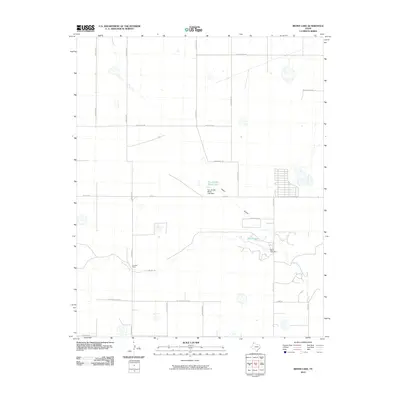
2010 Map of Bivins Lake
USGS Topo · Published 2010About this map
Palo Duro Creek winds through this High Plains landscape in Randall County, feeding into Bivins Lake where the Bivins Lake Dam regulates the local watershed. The area is characterized by large agricultural holdings and ranching estates, most notably the Forrester Ranch and the lands surrounding the Tom Gerald Ranch Lake. These private water resources, managed by structures like the Tom Gerald Ranch Lake Dam, are critical features in this semi-arid region south of the Canadian River basin. A grid of section-line roads, including Bushland Rd, Sampson Rd, and City Lake Rd, provides access to the scattered homesteads. Notable drainage features like the Negro Arroyo underscore the importance of water management in the rural development of the Texas Panhandle during the early 21st century.
Find a feature on this map
25 named features on this map. Tap any name to fly to it.
Don’t see what you’re looking for? This feature index may not catch every label — zoom into the map to look around manually.
Map Details
Editions of this 2010 Bivins Lake Map
This is the sole edition of this map. No revisions or reprints were ever made.
Other maps of this area

1954 · Tucumcari
USGS Topo · 1:250,000

1954 · Amarillo
USGS Topo · 1:250,000

1954 · Plainview
USGS Topo · 1:250,000

1954 · Clovis
USGS Topo · 1:250,000

1958 · Clovis
USGS Topo · 1:250,000

1958 · Amarillo
USGS Topo · 1:250,000

1958 · Tucumcari
USGS Topo · 1:250,000

1958 · Plainview
USGS Topo · 1:250,000

1960 · Canyon
USGS Topo · 1:62,500
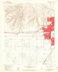
1960 · Amarillo West
USGS Topo · 1:24,000