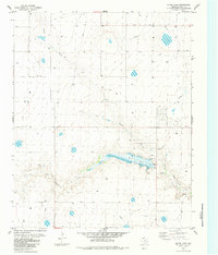
1984 Map of Bivins Lake
USGS Topo · Published 1984About this map
Bivins Lake forms the centerpiece of this Randall County landscape, where the waters of Palo Duro Creek are captured by a prominent Spillway. The terrain is defined by the sharp incisions of the Negro Arroyo as it cuts through the High Plains towards the creek bed. This 1984 edition, based on earlier aerial photography and field checks, reflects a mid-century ranching and utility infrastructure. Notable industrial and agricultural imprints include a large Feedlot and various Gravel Pit operations. The presence of a localized Aqueduct, a Pipeline, and a Substa highlights the managed water and energy systems required to sustain this Texas Panhandle environment. Numerous wells are scattered across the quadrangle, indicating the importance of groundwater to the local economy and land use during this era.
Find a feature on this map
12 named features on this map. Tap any name to fly to it.
Don’t see what you’re looking for? This feature index may not catch every label — zoom into the map to look around manually.
Map Details
Editions of this 1984 Bivins Lake Map
This is the sole edition of this map. No revisions or reprints were ever made.
Other maps of this area

1954 · Tucumcari
USGS Topo · 1:250,000

1954 · Amarillo
USGS Topo · 1:250,000

1954 · Plainview
USGS Topo · 1:250,000

1954 · Clovis
USGS Topo · 1:250,000

1958 · Clovis
USGS Topo · 1:250,000

1958 · Amarillo
USGS Topo · 1:250,000

1958 · Tucumcari
USGS Topo · 1:250,000

1958 · Plainview
USGS Topo · 1:250,000

1960 · Canyon
USGS Topo · 1:62,500
1960 · Amarillo West
USGS Topo · 1:24,000