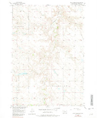
1956 Map of Black Horse SE
USGS Topo · Published 1981About this map
Firesteel Creek winds through this section of Corson County, shaping a landscape defined by expansive prairies and strategic water management. Surveyed in the mid-1950s, the map reveals a rural economy supported by local landmarks like Bohle Dam and the nearby Spillway 2103. The settlement pattern is characterized by its isolation, with the social fabric of the area anchored by several small country schools. These institutions, including Liberty Sch in the northwest and Severns Sch near the southern boundary, served a dispersed population of ranching and farming families. The prominent terrain of Pleasant Ridge overlooks Standing Cloud Creek, providing a geographic anchor for researchers tracing family land tracts or studying the development of the Missouri River Basin during the mid-20th century.
Find a feature on this map
12 named features on this map. Tap any name to fly to it.
Don’t see what you’re looking for? This feature index may not catch every label — zoom into the map to look around manually.
Map Details
Editions of this 1956 Black Horse SE Map
2 editions found
Other maps of this area

1953 · McIntosh
USGS Topo · 1:250,000

1956 · Miscol SW
USGS Topo · 1:24,000

1956 · Black Horse NE
USGS Topo · 1:24,000

1956 · Black Horse SW
USGS Topo · 1:24,000

1956 · Black Horse SE
USGS Topo · 1:24,000

1956 · Black Horse
USGS Topo · 1:24,000

1956 · Miscol
USGS Topo · 1:24,000

1958 · McIntosh
USGS Topo · 1:250,000

1978 · Brewer Butte
USGS Topo · 1:24,000

1978 · Isabel
USGS Topo · 1:24,000