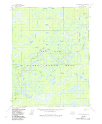
1956 Map of Black River D-6
USGS Topo · Published 1985About this map
The Yukon Flats dominate this 1950s interior landscape, characterized by a complex network of meandering waterways and seasonal wetlands. The Porcupine River snakes through the center of the sheet, joined by the Chandalar River and the Black River as they thread through the expansive Arctic National Wildlife Refuge. This environment, defined by its shifting sloughs and numerous lakes like Sams Big Lake and Moosehorn Lake, supported a lifestyle of movement and subsistence long before modern infrastructure.
Find a feature on this map
33 named features on this map. Tap any name to fly to it.
Don’t see what you’re looking for? This feature index may not catch every label — zoom into the map to look around manually.
Map Details
Editions of this 1956 Black River D-6 Map
3 editions found
Other maps of this area

1951 · Fort Yukon
USGS Topo · 1:250,000

1951 · Black River
USGS Topo · 1:250,000

1951 · Coleen
USGS Topo · 1:250,000

1951 · Christian
USGS Topo · 1:250,000

1956 · Coleen
USGS Topo · 1:250,000

1956 · Fort Yukon C-1
USGS Topo · 1:63,360

1956 · Black River D-6
USGS Topo · 1:63,360

1956 · Coleen A-5
USGS Topo · 1:63,360

1956 · Black River D-5
USGS Topo · 1:63,360

1956 · Black River C-6
USGS Topo · 1:63,360