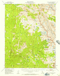
1953 Map of Blackcap Mtn
USGS Topo · Published 1957About this map
Diamond D Ranch and Chamberlains Camp sit amidst a high-altitude landscape of the Sierra National Forest, just prior to the expansion of recreational infrastructure in the mid-1950s. The map captures the remote eastern boundary of Fresno County, where the South Fork San Joaquin River and the North Fork Kings River find their headwaters among glacier-carved basins. A network of pack trails links features like Hell For Sure Pass and Post Corral Meadows, while the famed John Muir Trail traverses the eastern edge through Evolution Valley. This record reflects an era when the high Sierra was primarily accessed by foot or horseback, documented here before the shift toward modern wilderness management. Notable landmarks such as Maxson Dome and the Devils Punchbowl illustrate the complex topography that defines this portion of Kings Canyon National Park.
Find a feature on this map
115 named features on this map. Tap any name to fly to it.
Don’t see what you’re looking for? This feature index may not catch every label — zoom into the map to look around manually.
Map Details
Editions of this 1953 Blackcap Mtn Map
4 editions found

Other maps of this area

1903 · Tehipite
USGS Topo · 1:125,000

1904 · Kaiser
USGS Topo · 1:125,000

1905 · Tehipite
USGS Topo · 1:125,000

1912 · Mt. Goddard
USGS Topo · 1:125,000

1922 · Trimmer
USGS Topo · 1:96,000

1924 · Dinuba
USGS Topo · 1:125,000

1947 · Mariposa
USGS Topo · 1:250,000

1948 · Fresno
USGS Topo · 1:250,000

1948 · Mariposa
USGS Topo · 1:250,000

1948 · Mt. Goddard
USGS Topo · 1:62,500