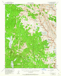
1953 Map of Blackcap Mtn
USGS Topo · Published 1962About this map
The high Sierra Nevada backcountry, as mapped by the State of California Director of Water Resources and federal surveyors, reveals a landscape of high-altitude water management and wilderness recreation. The creation of Courtright Reservoir and Wishon Reservoir on Helms Creek and the North Fork Kings River signals the era's mid-century focus on hydroelectric power and storage. The map tracks the winding path of the John Muir Trail through Kings Canyon National Park, connecting the Glacier Divide and the Evolution Valley. Significant landmarks for high-country travelers include the Diamond D Ranch, Chamberlains Camp, and numerous named meadows like Blaney Meadows. The terrain is characterized by dramatic granite features such as Pavilion Dome and challenging crossings like Hell For Sure Pass, which provides access to the lake-studded Red Mtn Basin and the Devils Punchbowl.
Find a feature on this map
120 named features on this map. Tap any name to fly to it.
Don’t see what you’re looking for? This feature index may not catch every label — zoom into the map to look around manually.
Map Details
Editions of this 1953 Blackcap Mtn Map
4 editions found

Other maps of this area

1903 · Tehipite
USGS Topo · 1:125,000

1904 · Kaiser
USGS Topo · 1:125,000

1905 · Tehipite
USGS Topo · 1:125,000

1912 · Mt. Goddard
USGS Topo · 1:125,000

1922 · Trimmer
USGS Topo · 1:96,000

1924 · Dinuba
USGS Topo · 1:125,000

1947 · Mariposa
USGS Topo · 1:250,000

1948 · Fresno
USGS Topo · 1:250,000

1948 · Mariposa
USGS Topo · 1:250,000

1948 · Mt. Goddard
USGS Topo · 1:62,500