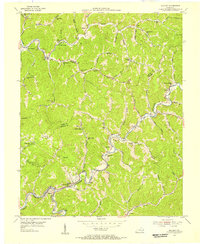
1954 Map of Blackey
USGS Topo · Published 1956About this map
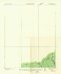
Rockhouse Creek and the L & N railroad corridor define the industrial and social heart of this Knott and Letcher County borderland. In the mid-1950s, the landscape is punctuated by coal-era settlements and hollows where community life centered on small local institutions. Along the winding waterways, map users can locate numerous country schools such as Jeremiah Sch, Breeding Cr Sch, and Buffalo Sch, alongside the prominent Indian Bottom Ch. The map captures a transition in naming and place, featuring distinctive coal-camp names like Carbon Glow and the evocative Hot Spot. The rugged geography is marked by local landmarks like Horse Mill Point and numerous small family or community cemeteries, reflecting a period when topographical constraints kept development tightly clustered along the creek beds and rail spurs.
Find a feature on this map
86 named features on this map. Tap any name to fly to it.
Don’t see what you’re looking for? This feature index may not catch every label — zoom into the map to look around manually.
Map Details
Editions of this 1954 Blackey Map
4 editions found
Other maps of this area

1890 · Whitesburg
USGS Topo · 1:125,000

1891 · Hazard
USGS Topo · 1:125,000

1892 · Whitesburg
USGS Topo · 1:125,000

1912 · Hindman
USGS Topo · 1:48,000

1913 · Oven Fork
USGS Topo · 1:48,000

1914 · Troublesome
USGS Topo · 1:62,500

1915 · Hindman
USGS Topo · 1:62,500

1915 · Whitesburg
USGS Topo · 1:62,500

1916 · Cornettsville
USGS Topo · 1:62,500
1935 · Pardee
USGS Topo · 1:24,000