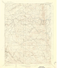
1906 Map of Blackhawk
USGS Topo · Published 1939About this map
Blackhawk and the surrounding Front Range canyons define this 1904 survey, which reveals the dense network of ranches and mining camps established during Colorado's early mountain development. The map follows the steep transition from the foothills at Ralston Buttes into the high country, where the Colorado and Southern railroad serves the industrial heart of the district. The landscape is dotted with early mountain settlements and family-named landmarks like Pactolus, Rollinsville, and Magnolia, while isolated structures such as the Pine Glade School mark the community centers for remote ranching families.
Find a feature on this map
70 named features on this map. Tap any name to fly to it.
Don’t see what you’re looking for? This feature index may not catch every label — zoom into the map to look around manually.
Map Details
Editions of this 1906 Blackhawk Map
5 editions found
Other maps of this area

1899 · West Denver
USGS Topo · 1:125,000

1902 · Boulder
USGS Topo · 1:62,500

1903 · Georgetown
USGS Topo · 1:62,500

1904 · Niwot
USGS Topo · 1:62,500

1904 · Boulder
USGS Topo · 1:62,500

1905 · Central City
USGS Topo · 1:62,500

1905 · Georgetown
USGS Topo · 1:62,500

1906 · Blackhawk
USGS Topo · 1:62,500

1910 · Central City
USGS Topo · 1:62,500

1912 · Central City
USGS Topo · 1:62,500