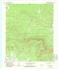
1966 Map of Blackjack Ridge
USGS Topo · Published 1986About this map
Winding Stair Mountain dominates this portion of the Ouachita National Forest in Le Flore County, Oklahoma. The terrain is defined by a series of steep, creek-cut ridges including Blackjack Ridge and Buffalo Wallow Mountain, which rise sharply from the lowlands. Human presence is concentrated along the Holson Valley Road and the northern boundary near Summerfield, while the interior remains largely undeveloped forest land. Significant navigational and fire-monitoring infrastructure is visible at the Sycamore Lookout Tower and a nearby Radio Tower. For the local historian or outdoorsman, the map traces numerous drainage systems like Cedar Creek and Bohannon Creek alongside local landmarks such as Boardstand Flat and Compton Hollow. A pipeline and isolated gravel pits indicate the modest industrial footprint within the forest during the mid-1960s.
Find a feature on this map
31 named features on this map. Tap any name to fly to it.
Don’t see what you’re looking for? This feature index may not catch every label — zoom into the map to look around manually.
Map Details
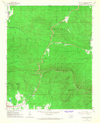
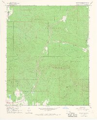
Editions of this 1966 Blackjack Ridge Map
3 editions found
Other maps of this area

1900 · Winding Stair
USGS Topo · 1:125,000

1901 · Tuskahoma
USGS Topo · 1:125,000

1908 · Tuskahoma
USGS Topo · 1:125,000

1909 · Tuskahoma
USGS Topo · 1:125,000

1909 · Winding Stair
USGS Topo · 1:125,000

1940 · Red Oak
USGS Topo · 1:62,500

1943 · Red Oak
USGS Topo · 1:62,500

1950 · Mcalester
USGS Topo · 1:250,000

1962 · McAlester
USGS Topo · 1:250,000

1965 · McAlester
USGS Topo · 1:250,000