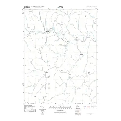
2011 Map of Blacksville
USGS Topo · Published 2011About this map
Blacksville and its surrounding rural communities are captured in this 2011 topographic record of Monongalia County, West Virginia. The landscape is defined by the winding course of Dunkard Creek, which snakes through the northern portion of the map past landmarks like The Cliff and the Minor Bridge. The survey reveals a dense concentration of family cemeteries, such as the Strosnider Cemetery, McCoy Cemetery, and Hagans Cemetery, providing a wealth of information for genealogists and local historians tracking the lineage of the Jakes Run and Daybrook areas. This network of small burial grounds, often tucked on ridges or near small tributaries like Indian Camp Run, reflects the long-standing family settlement patterns characteristic of the Appalachians. The presence of Mount Harmon Dam and the various small towns like Mooresville and Pentress illustrate the continued importance of the valley floors for both infrastructure and residential life.
Find a feature on this map
105 named features on this map. Tap any name to fly to it.
Don’t see what you’re looking for? This feature index may not catch every label — zoom into the map to look around manually.
Map Details
Editions of this 2011 Blacksville Map
This is the sole edition of this map. No revisions or reprints were ever made.
Other maps of this area

1901 · Waynesburg
USGS Topo · 1:62,500

1904 · Blacksville
USGS Topo · 1:62,500

1904 · Waynesburg
USGS Topo · 1:62,500

1905 · Mannington
USGS Topo · 1:62,500

1905 · Rogersville
USGS Topo · 1:62,500

1923 · Blacksville
USGS Topo · 1:62,500

1923 · Mannington
USGS Topo · 1:62,500

1925 · Blacksville
USGS Topo · 1:62,500

1926 · Mannington
USGS Topo · 1:62,500

1949 · Clarksburg
USGS Topo · 1:250,000