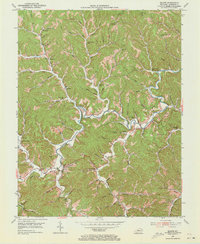
1953 Map of Blaine
USGS Topo · Published 1973About this map
The settlement of Blaine serves as the focal point for this mid-century survey of the Appalachian foothills in Lawrence County. In the early 1950s, the landscape was a patchwork of ridge-top farms and narrow hollows, connected by a network of one-room schoolhouses like Rockhouse Sch and Chestnut Grove Sch. The community of Houckville and the high point at Olevinger Knob, topped with its Lookout Tower, define the northern reaches. Along the meandering Blaine Creek, small church congregations at Oak Hill Ch and Elm Grove Ch reflect the social fabric of rural eastern Kentucky. Evidence of regional industry is clear in the Oil and Gas Field near Hannah, where several Gas Wells are tucked into the drainages of Cains Creek.
Find a feature on this map
99 named features on this map. Tap any name to fly to it.
Don’t see what you’re looking for? This feature index may not catch every label — zoom into the map to look around manually.
Map Details
Editions of this 1953 Blaine Map
4 editions found
Other maps of this area

1886 · Prestonsburg
USGS Topo · 1:125,000

1892 · Prestonsburg
USGS Topo · 1:125,000

1903 · Kenova
USGS Topo · 1:125,000

1904 · Kenova
USGS Topo · 1:125,000

1911 · Louisa
USGS Topo · 1:48,000

1913 · Louisa
USGS Topo · 1:62,500

1914 · Inez
USGS Topo · 1:48,000

1915 · Paintsville
USGS Topo · 1:48,000

1916 · Inez
USGS Topo · 1:62,500

1917 · Paintsville
USGS Topo · 1:62,500