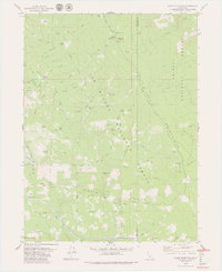
1979 Map of Blake Mountain
USGS Topo · Published 1979About this map
The South Fork Trinity River and the Mad River carve through the high ridges of Humboldt and Trinity Counties, marking a landscape defined by forestry and remote outpost stations in the late 1970s. This survey captures a transitional era where early settlement traces like the Becker Cabin (Site) and Torrey Corrals persist alongside the active infrastructure of the Six Rivers National Forest and Trinity National Forest. Prominent peaks such as Blake Mountain serve as anchor points for a network of fire-lookout stations and pack trails, including the Eightmile Lookout and the Last Chance Trail. Grounded in the topographic reality of the Pacific Northwest, the map details numerous specific water sources and clearings, from Happy Jack Spring to Severin Openings, reflecting a period when seasonal camps like Shell Camp and crossings like Anderson Ford were vital for navigating the steep, drainage-cut terrain.
Find a feature on this map
57 named features on this map. Tap any name to fly to it.
Don’t see what you’re looking for? This feature index may not catch every label — zoom into the map to look around manually.
Map Details
Editions of this 1979 Blake Mountain Map
3 editions found
Other maps of this area

1909 · Big Bar
USGS Topo · 1:96,000

1914 · Pilot Creek
USGS Topo · 1:62,500

1915 · Big Bar and Vicinity
USGS Topo · 1:250,000

1918 · Anada
USGS Topo · 1:62,500

1931 · Hoaglin
USGS Topo · 1:96,000

1935 · Hoaglin
USGS Topo · 1:125,000

1949 · Blocksburg
USGS Topo · 1:62,500

1951 · Blocksburg
USGS Topo · 1:62,500

1951 · Pilot Creek
USGS Topo · 1:62,500

1951 · Hyampom
USGS Topo · 1:62,500